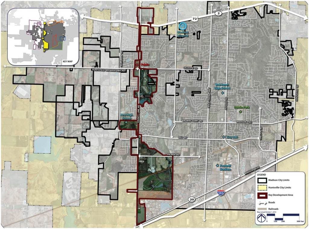
03 County Line Road Survey
County Line Road
The County Line Road corridor represents a boundary for the City of Madison. Not just the edge between Limestone and Madison counties, but also the seam between existing Madison and future development potential. The area being studied runs from I-565 to the south, all the way to Highway 72 at the northern edge of the City. Between those two points, the corridor has hundreds of new housing units, and vast potential for a variety of development.
You will be asked to rate several images based on how well you feel they would fit into this area, from “one star” (not at all appropriate) to “five stars” (very appropriate). You will also be asked some short answer questions, to get your input on how you think the corridor should change (if at all) over the next ten to twenty years.
![]()